The Gulf of Maine
Introduction
The Gulf of Maine is a large body of water that encompasses a large area in the northeast of North America. Within the Gulf of Maine there are several different habitats both physical and biological that are home to a number of different organisms. The Gulf of Maine provides an extremely rich biodiversity because of the nice transition that the gulf offers from a freshwater to marine environment. Within the Gulf of Maine there are some 3300 different species of fish, birds, marine mammals, invertebrates, plants, and microscopic life. While the rich biodiversity in the Gulf of Maine is a nice addition aesthetically, it also comes at a price as the gulf has been exposed to many years of commercial exploitation. The gulf has had years of human disturbance and human development along its coastline. Nonetheless the gulf continues to be a rich environment that hopefully will continue to be vibrant and bountiful in its biodiversity.
Location
a

[9]
Located in the Northeast coast of North America from Cape Cod to New Brunswick and Nova Scotia[1]. The coastline includes the U.S. states Massachusetts, New Hampshire and Maine and includes the Canadian provinces New Brunswick and Nova Scotia. The Gulf of Maine is located from 41°N in the south of the gulf to 46°N in the north of the gulf and from -70°W in the west of the gulf to -68°W in the east of the gulf.
Physical Features
a
[10]
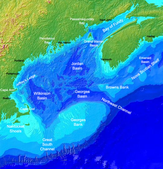
The coastline of the Gulf of Maine extends for about 12000 kilometers from Cape Cod to Cape Sable in Nova Scotia. The entire watershed of the Gulf of Maine covers an area of about 179,000 square kilometers. Within the Gulf of Maine there are three large basins which include the Georges, Wilkinson, and Jordan. The Georges basin is the largest having an average depth of about 350m. The Gulf of Maine itself covers an area of about 93000 square kilometers and is 150 meters deep on average. The deepest the Gulf reaches is up to 500 meters[2]. The outer Georges Bank is extremely important to the Gulf of Maine as it protects it from the north blowing gulf stream that brings warmer and less productive waters. The Labrador current that runs down from the Arctic Ocean brings to the Gulf of Maine colder and more productive water. The Laurentide Ice sheet was the last major ice sheet that advanced from northern Canada and came to southern New England. As it approached New England it scoured the bedrock surface of Maine, removing loose material from the surface and creating the underlying bedrock that is present today[3].
Primary Productivity
a
[11]
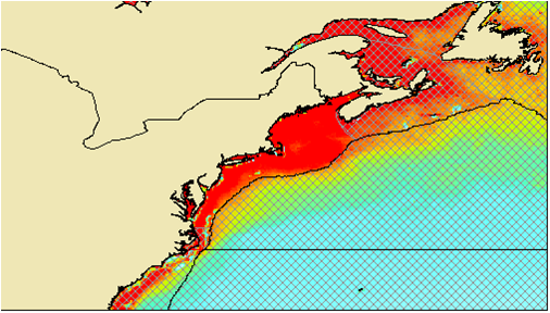
The Gulf of Maine has an annual average primary productivity of 1,124 mgC·m-2·day -1[4].
The primary productivity starts to peak around 1500 mgC·m-2·day -1 in the late summer months and early to mid fall months . During the winter months however the primary productivity is very low sitting around 600 mgC·m-2·day -1 on average.
The primary productivity starts to peak around 1500 mgC·m-2·day -1 in the late summer months and early to mid fall months . During the winter months however the primary productivity is very low sitting around 600 mgC·m-2·day -1 on average.
Gulf of Maine Habitats
Physical Habitats:
[12]
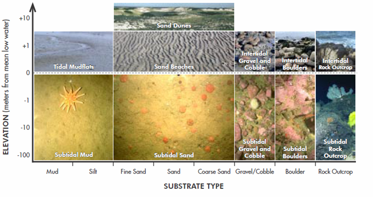
The Gulf of Maine contains a wide variety of physical habitats that contain different types of substrate and sediment that help to support a wide variety of life. Some of these physical habitats include mudflats, sandy beaches, sand dunes, and intertidal regions that have gravel, cobble, boulder. These physical habitats extend farther up in elevation like the sandy dunes down to the intertidal regions where they are covered or exposed depending on where the tide level is and finally on down to the subtidal regions where they are always underwater[5].
Biological Habitats:
[13]
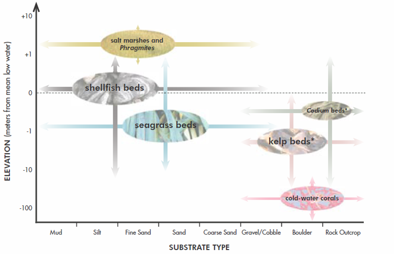
On top of a wide variety of physical habitats the Gulf of Maine has a wide variety of biological habitats that help to maintain a very diverse and beautiful landscape. These biological habitats include salt marshes, shellfish beds, seagrass beds, codium beds, kelp beds, and cold water corals. Each of these biological habitats occurs in different regions of the coastal areas and within different physical habitats. The seagrass beds, shellfish beds and salt marshes occur in areas of muddy and sandier substrates, while the codium beds, kelp beds and cold water corals occur in regions that are rockier and deeper within the water column[6].
Biodiversity
a
The Gulf of Maine has a wide range of organisms living within its borders. Each one of the organisms inhabiting the Gulf of Maine is important, but some of the organisms may prove to be more valuable to the overall cycle than others. To look at these different organisms the biodiversity has been broken up into the most important biological habitats including salt marshes, seagrass beds and kelp beds.
Salt Marshes:
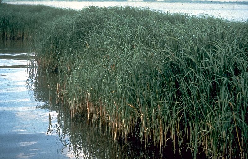
[14]
The Salt Marshes within the Gulf of Maine are dominated by Spartina alterniflora in the lower marsh while in the higher regions Spartina patens is the dominant species which is a saltmeadow hay. Some of the typical species that tend to inhabit the Salt Marsh are Ribbed mussels, Striped bass, and Fiddler crabs. The Ribbed mussels are filter feeders who find shelter within the tall Salt Marsh plant species. The Striped bass have been a historically exploited species as they are a prime fishing species for many sporting fishermen. Fiddler crabs are detritivores who break down decaying matter in the soil and allow for soil deposition within the Salt Marsh[7].
Seagrass Beds:
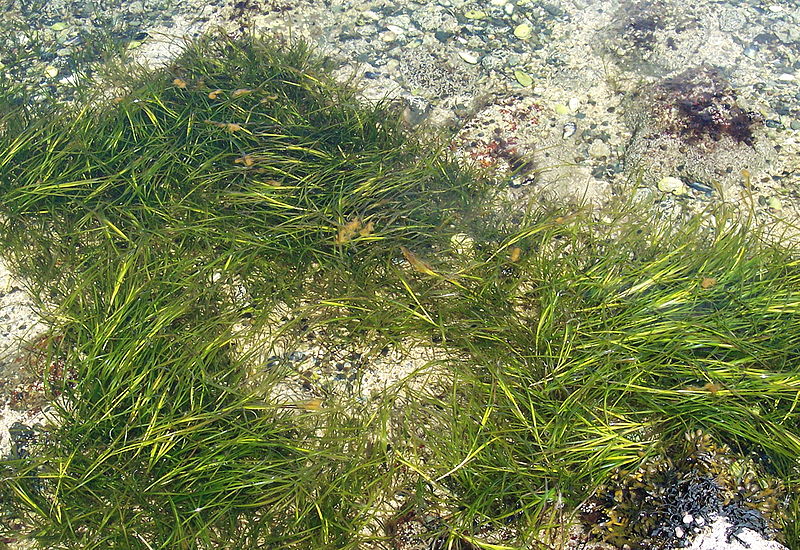
[15]
The Seagrass Beds within the Gulf of Maine are dominated by Zostera marina while a second species Ruppia maritima is also found commonly in the Seagrass Beds. Some of the common species found in the Seagrass Beds are Bay scallops, Winter flounder, Atlantic cod, and Mytilus edulis. All of these species are important for commercial harvest and for sustaining economic viability within the Gulf of Maine[8].
Kelp Beds:
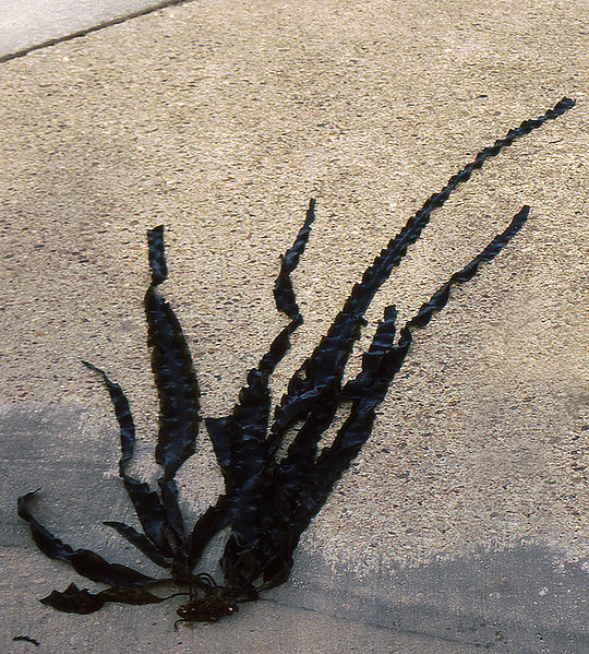
[16]
The Kelp Beds within the Gulf of Maine contain a few different species including Laminaria saccharina, Alaria esculenta and Agarum clathratum. The Kelp Beds are an extremely important biological habitat because they provide nutrients and shelter for many different organisms. Some of those organisms include Atlantic Lobster as well invasive species like Botryllus schlosseri and Botrylloides violaceus[9].
Food Web
a
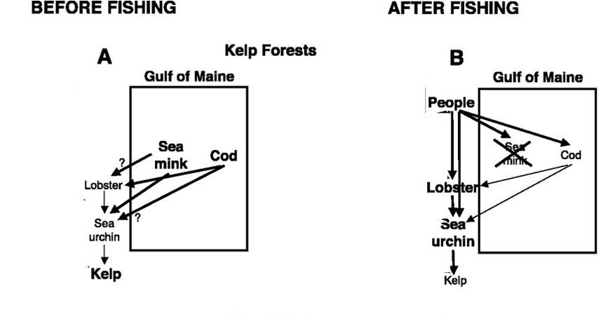
[17]
The Gulf of Maine has had a long history and tradition of fishing. But in that fishing history it has experienced strong declines in its fishing populations and sizes. Through the advent of faster and more technically sound ships the populations of cod and haddock have decreased considerably and are at levels way below what is considered to be sustainable. What is seen in the above food web is a perfect example of a trophic cascade that had seen the effects of before and after fishing. Before large overfishing, cod stocks were high thus making lobster and and sea urchin stocks low and kelp beds more abundant. After overfishing, cod stocks were devastated and lobster and sea urchin populations sky rocketed leading to decreases in kelp beds[10].
Historical Use of Region
a
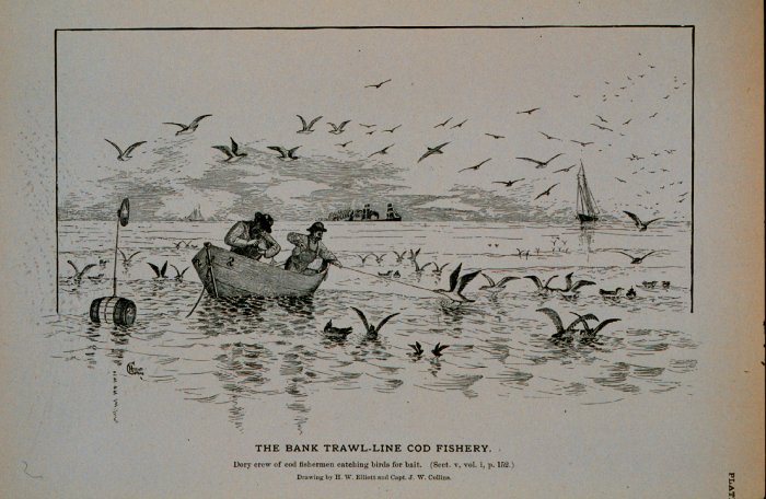
[18]
- 1498 John Cabot and his crew sailed into the Gulf of Maine
- 1524 Giovanni de Verrazzano cruises past the Maine coast under the French flag
- 1602 Bartholomew Gosnold names Cape Cod
- 1659 first shortage of cod in a Gulf of Maine fishery was documented by Massachusetts merchants
- 1691 Massachusetts lost its chartered independence and became a province of the crown
- 1711 a plan for forming an oyster bed in Plymouth is formulated by a company of thirty one men
- 1713 Treaty of Utrecht between France and England at the end of the War of Spanish Succession forbid the French from fishing within 30 leagues of the coast of Nova Scotia from Sable Island to the southwest
- 1762 British forces defeat French forces at the Battle of Signal Hill in the Seven Years War. The British now control all of eastern North America
- 1784 Jonathan Rowe a Boston merchant donates a large gilded pine codfish to the commonwealth which still hangs in the Massachusetts House of Representatives
- 1817 the captain of a coasting vessel and two ladies on shore reported seeing a sea serpent entering Gloucester harbor
- 1820 Maine becomes 31st state in the union
- 1834 the second volume of the birds of America is published by John Audubon
- 1851 there is 1260000 metric tons of cod in the Gulf of Maine
- 1861 there is 78000 metric tons of cod caught in the Gulf of Maine
- 1880 the last sea mink is trapped on an island in the Gulf of Maine
- 1882 the Albatross is launched as the first vessel for marine research only
- 1898 the late Professor Lee, of Bowdoin College, insisted upon the desirability of establishing a station for the study of marine forms in the Gulf of Maine
Habitat Changes
a
[19]
Each habitat within the Gulf of Maine has been affected by many of the same destructive practices that humans do on a daily schedule. However each habitat may be affected on smaller and larger scales. Some of the most important habitat changes that have taken place are point and non-point source pollution from coastal development as well industrial functioning that has led to eutrophication within the Gulf of Maine. The most important habitat change however has to be the epidemic of overfishing within the Gulf of Maine. The vast consumption of groundfish such as Haddock and Atlantic Cod has led to the increase in certain crustaceans like the Atlantic lobster and echinoderms like sea urchins. The increase in sea urchins has led to the destruction of many kelp beds within the Gulf of Maine.
Major Fisheries
a
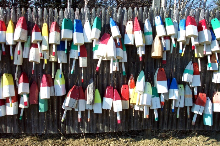
[20]
Some of the main Invertebrate fisheries within the Gulf of Maine are Atlantic Lobster, Northern Shrimp, Ocean Quahog, Atlantic Surf Clam, and the American Sea Scallop. Some of the main fish fisheries within the Gulf of Maine are split up into groups that have been historically fished and groups that have been fished at reasonable levels over the years and continued to be fished at consistent levels. Some of the historical fisheries include Atlantic Cod, Haddock, and Atlantic Pollock. Some of the consistent fisheries over the years include the Atlantic Menhaden and Atlantic Herring. Both groups have been heavily exploited over the years, but fish like the Menhaden and the Herring are able to recover faster due to the fact that they are lower in the trophic level and thus do not need as long to develop. Additionally they feed on plankton which are always in high abundance in comparison to higher trophic level organisms. On the opposite side fish like Cod and Haddock are higher on the trophic level so take longer to develop and also feed on organisms that are higher trophically so are not as high in abundance. Due to these type of physical restrictions things like Cod do not recover as fast when heavily exploited.
Fishery Management
a
[21]
The management within the Gulf of Maine lies mainly under the jurisdiction of NOAA which is the National Oceanic and Atmospheric Administration. However since not all of the Gulf of Maine lies within US waters, it is not solely regulated by US agencies. Instead the other waters within the Gulf of Maine are regulated by Canada under the DFO which is the Department of Fisheries and Oceans. Both NOAA and the DFO regulate the waters within the Gulf of Maine from three to two hundred miles out from the coast. Each agency is set up to regulate such things catch sizes, mesh sizes, time of year that fishermen are able to exploit certain species as well as to enforce the Magnuson-Stevens Act. The Magnuson-Stevens Fishery Conservation and Management Act was set up in 1976 by Warren Magnuson, a former senator from Washington state and Ted Stevens, a former senator from Alaska. The act itself was first set up get rid of international fleets fishing in US coastal waters up to 200 miles out which is designated as a country's exclusive economic zone(EEZ). Secondly the act was put in place to try and maximize yield out of all the fisheries within the US by discouraging overfishing and encouraging fishing practices that are practical and sustainable[11]. One of the last things it did was to set up 8 regional councils which were put in place to carry out the aims of the Magnuson-Stevens Act and enforce fishing regulations within each of their areas[12]. The Regional council set in place to manage the Gulf of Maine is the New England Fishery Management Council, which has nine fishery management plans set in place to regulate the different types of fisheries. The different types of fisheries under the New England councils control are the northeast multispecies(groundfish), scallop, monkfish, herring, smallmesh multispecies(whiting and two stocks of hake), red crab and northeast skate complex. The other main management agency set in place is the Atlantic States Marine Fisheries Commission. The main fishery that it oversees is the lobster fishery. Again it is set in place to regulate catch sizes, mesh sizes and the time of year that lobster can be taken out of the ocean waters.
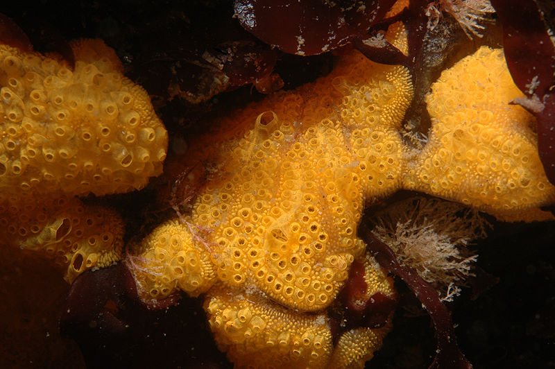
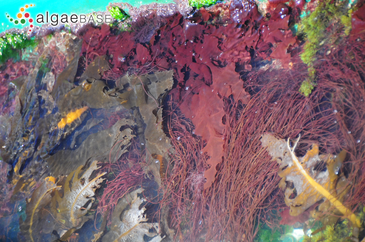
Introduced Species
a
The Gulf of Maine has several different types of introduced species that have come from all over the world. Much of what has been introduced has been because of shipping that has gone in and out of the Gulf of Maine. Usually the introduced species either accumulate in ballast water or through fouling in which they build on the hull or surface of ships. However some species have been introduced through such practices as aquaculture. Some of the main introduced species include Grateloupia turuturu, Didemnum vexillum and Botrylloides violaceus[13]. Grateloupia turuturu is a widespread red alga from Asia that may hinder native algal biomass by competing for resources and shading. Didemnum vexillum is thought to be first introduced from aquaculture when it hitched a ride on oysters. Didemnum vexillum is able to overgrow and displace many different organisms and communities within the Gulf of Maine. If Didemnum vexillum is allowed to grow larger communities it could influence the recruitment of other species, modify habitat and lead to the death of many bivalves by overgrowing their siphons. Botrylloides violaceus is a colonial tunicate that attaches itself to kelp blades. It has become problematic as it has decreased light penetration for kelp and has led to dislodgement of kelp by creating drag on the blade.
[22]
[23]

[24]
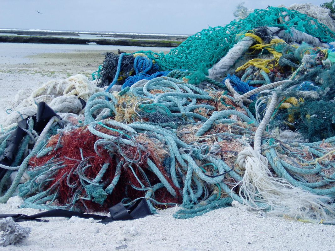
Pollution
a
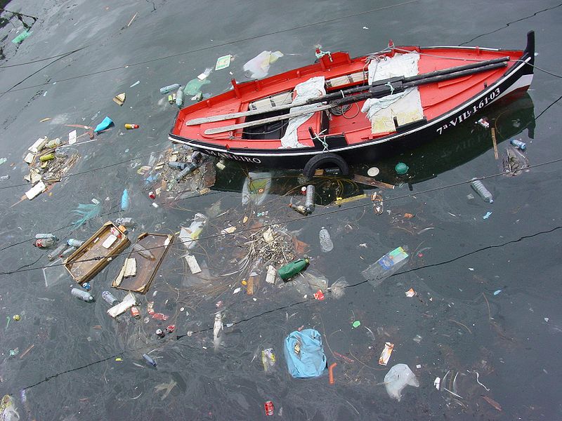
[25]
There are multiple examples of pollution within the Gulf of Maine that can be split into two groups: point source pollution and non-point source pollution. Point source pollution is pollution that can be specifically pinpointed and tracked. While there is still point source pollution that occurs, it has become a relatively small issue because of all the legislation that has been put into place in the past. The main pieces of legislation include the Clean Water Act of 1987 and the Clean Air Act of 1977[14]. These acts forced industrial facilities to limit the amount of discharge that they would put into a given body of water based on the quality of that water. It also requires all industrial facilities to get a permit from the National Pollutant Discharge Elimination System(NPDES). Some of the main sources of point source pollution in the past include manufacturing plants, mining, oil and gas extraction, and several service industries. Where the real problem lies however is in non-point sources because non-point sources are defined as sources of pollution that cannot be easily pointed out and pinpointed. For this reason the federal government does not require permits for non-point sources to be discharged into bodies of water. Within the gulf some of the pollutants include polycyclic aromatic hydrocarbons(PAHs), polychlorinated biphenyls(PCBs), chlorinated pesticides like DDT, metals and noise. The most productive way in which the United States has dealt with these pollutants is to develop sewage waste treatment plants. As all human waste is about 70% organic, the sewage plants are able to deal with that 70% by using regimented steps that filter out different materials within the sewage. Noise is a newly pointed out source of pollution, in which scientists still do not all the effects of on different populations[15]. For marine mammals and whales in particular noise is known to have extremely damaging effects by interfering with their communication. Noise on fish may have extremely damaging effects by creating hearing loss and changes in their distribution.
Overfishing
a
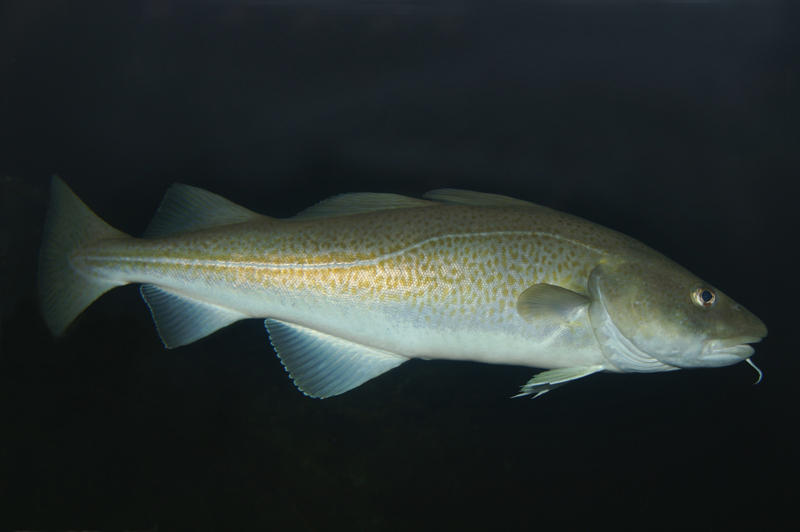
[26]
Overfishing in the Gulf of Maine has always been the main issue and continues to be the main issue to this day. It is a wide encompassing problem that leads to several different issues such as bycatch and pollution, but the main issue continues to be that fishermen are simply still taking too many species out of the gulf and surrounding Georges Bank. Traditional overfished species include Atlantic Cod, Haddock, Yellowtail Flounder and Striped Bass. Because these species have been so heavily exploited in the past, fisheries have had to start taking larger catches of other species. These include Atlantic Lobster, American Sea Scallop, Northern Shrimp and Ocean Quahog. In looking at grounfish in particular the species of Atlantic Cod, Haddock, Hake and Flounder have been exploited for hundreds of years. This type of persistent exploitation has taken its toll over the years and left many of these species scrambling to keep up with their heavy exploitation. While many of these species have been declared not overfished within the Gulf of Maine there is still overfishing being done. Atlantic Cod was just declared not overfished in 2010 because it is at 58% of its target level and Haddock is at 99% of its target level[16]. Yellowtail Flounder on other hand is at 25% of its target level and is considered overfished[17]. While for Haddock and Atlantic Cod it may seem positive that they are not considered overfished it is still not an indication that they will recover to their historic levels. What really changed the life history for many of these groundfish was the advent of technology. Beginning in 1906 when steam trawlers were born and nets were used to catch groundfish the catches were bound to be heavily exploited. The next big change was in the 60's when shipping technology took off and ships became bigger, faster and more efficient. Groundfish species never stood a chance against those odds and to this day have not been able to recover to what they used to be because of how decimated their populations were in the 20th century. A side issue to overfishing is the amount of bycatch that comes along with heavily exploiting several fish species. The Food and Agriculture Organization estimates there is 80000 metric tons of bycatch of unintended species every year in the northwest Atlantic[18]. Beyond the scope of just groundfish, fisheries are decimating the populations of many different species living within the Gulf of Maine because of the type of fishing that is done. The main types of fishing that are done are otter trawls, purse seining, lobster traps, and dredging. Each one of these types of fishing practices can have significant impacts on the particular habitat in which they are used.
Potential Solutions
a

[27]
To deal with overfishing and overfished populations there have been many suggestions, but the most sensible ones include setting harsher catch limits, creating marine reserves and utilizing aquaculture to recover groundfish populations. Catch limits is the solution that has really been the only one that has been utilized up till this point. The New England Fishery Management Council(NEFMC) which is responsible for regulating many of the species in the Gulf of Maine including all the groundfish has been responsible for setting the catch limits. Starting in 1999 the NEFMC wanted to implement an amendment that stopped overfishing and helped rebuild overfished groundfish stocks. The 13th amendment was eventually drafted in 2001, but immediately after it was drafted the Conservation Law Foundation filed a law suit against it because it did not do enough to end overfishing and it did not include enough measurements to limit bycatch[19]. The Conservation Law Foundation won the suit and the NEFMC had to re-write the amendment. It was not finished until 2004 when it was finally re-drafted. Some of the implementations were to limit 800 lbs of groundfish per day at sea and 4000 lbs of groundfish per trip in the Gulf of Maine. Some of the other limitations were to establish minimum mesh size nets for trawl gear including sizes of 16.5cm diamond or square in the codend only and 21.59cm diamond or square for the entire net[20]. The next best solution to recover groundfish stocks are to establish marine reserves. Marine reserves are defined as no-take zones that do not allow any fishing of any kind. To see if marine reserves would actually work and how to build marine reserves the Stellwagen Bank National Marine Sanctuary conducted a study on the movement of Atlantic Cod in relation to habitat structure. They first set study sites at four different piled boulder reefs from 2002 to 2005[21]. They next used a sun-illuminated bathymetric tool to map the seafloor in the entire Stellwagen Bank and identify piled boulder reefs. After the study was concluded, it was established that greater than 90% of the Cod showed high site fidelity to where they were originally caught and tagged. This was a good indicator that Cod are site-specific and thus that marine reserves might be possible to improve cod stocks. While there are no marine reserves currently in place right now in the Gulf of Maine there is an extensive network of marine protected areas that are set up both by individual states and the federal government through NOAA. There are several different types of marine protected areas including zoned and multiple use areas, no-take areas, no impact areas, and no access areas. Marine protected areas on the whole do at least a little bit to curtail overfishing by setting harsher limits or at least some restrictions as to what can and cannot be done in a specific area. The last solution that has been suggested is to use aquaculture as a means to recover to groundfish stocks. By using a series of cages that are placed 14km offshore juvenile groundfish could be grown to adult sizes[22]. However much of the discussion has been to use aquaculture merely as a commercial interest instead of actually releasing spawning adult populations back into the wild.
Interactive mapping tool for marine protected areas
Interactive mapping tool for marine protected areas
References
Work References:
[1]Wikipedia. Gulf of Maine. http://en.wikipedia.org/wiki/Gulf_of_Maine
[2]Wikipedia. Gulf of Maine. http://en.wikipedia.org/wiki/Gulf_of_Maine
[3]A Geologic History of the Gulf of Maine. Manahan, Abigail. Bigelow Laboratory for Ocean Sciences. http://www.gulfofmaine-census.org/about-the-gulf/physical-characteristics/geology/geologic-history/
[4]SeaAroundUsProject. The PEW Charitable Trusts. http://www.seaaroundus.org/data/
[5]Tyrrell, M.C. 2005. Gulf of Maine Marine Habitat Primer. Gulf of
Maine Council on the Marine Environment, 54 pages.http://www.gulfofmaine.org/habitatprimer/
[6]Tyrrell, M.C. 2005. Gulf of Maine Marine Habitat Primer. Gulf of
Maine Council on the Marine Environment, 54 pages.http://www.gulfofmaine.org/habitatprimer/
[7]Tyrrell, M.C. 2005. Gulf of Maine Marine Habitat Primer. Gulf of
Maine Council on the Marine Environment, 54 pages.http://www.gulfofmaine.org/habitatprimer/
[8]Tyrrell, M.C. 2005. Gulf of Maine Marine Habitat Primer. Gulf of
Maine Council on the Marine Environment, 54 pages.http://www.gulfofmaine.org/habitatprimer/
[9]Tyrrell, M.C. 2005. Gulf of Maine Marine Habitat Primer. Gulf of
Maine Council on the Marine Environment, 54 pages.http://www.gulfofmaine.org/habitatprimer/
[10]Jackson, Jeremy B.C. Historical Overfishing and the Recent Collapse of Coastal Ecosystems. July 2001. Vol 293, pp.629-637. http://www.sciencemag.org/content/293/5530/629.full
[11]Wikipedia. Magnuson-Stevens Fishery Conservation and Management Act. http://en.wikipedia.org/wiki/Magnuson%E2%80%93Stevens_Fishery_Conservation_and_Management_Act
[12]Wikipedia. Magnuson-Stevens Fishery Conservation and Management Act. http://en.wikipedia.org/wiki/Magnuson%E2%80%93Stevens_Fishery_Conservation_and_Management_Act
[13]Pappal, Adrienne. Marine Invasive Species: State of the Gulf of Maine Report. June 2010.pp21. www.gulfofmaine.org/state-of-the-gulf/docs/marine-invasive-species.pdf
[14]Wikipedia. Clean Water Act. http://en.wikipedia.org/wiki/Clean_Water_Act
[15]Schuman, Carrie. Sounding the Alarm: The emerging threat of noise pollution. December 2009. http://www.gulfofmaine.org/gomt/?p=30
[16]Fish Watch: US Seafood Facts. NOAA and NMFS.http://www.nmfs.noaa.gov/fishwatch/species/atlantic_cod.htm
[17]Fish Watch: US Seafood Facts. NOAA and NMFS. http://www.nmfs.noaa.gov/fishwatch/species/yellowtail_flounder.htm
[18]FAO. Estimates of Global Fishery Bycatch and Discards. http://www.fao.org/docrep/003/t4890e/T4890E02.htm#ch1
[19]New England Fishery Management Council. Background and Purpose. http://www.nefmc.org/
[20]New England Fishery Management Council. Background and Purpose. http://www.nefmc.org/
[21]Lindholm, J. Movement of Atlantic Cod. Stellwagen Bank Marine Sanctuary. http://stellwagen.noaa.gov/science/site_fidelity.html
[22]Chambers, Michael D. Preliminary Information on Cod and Haddock Production in Submerged Cages off the Coast of New Hampshire, USA. October 2005. pp.385-392. http://icesjms.oxfordjournals.org/content/63/2/385.full
Image References:
[1]http://www.photolib.noaa.gov/htmls/line2838.htm
[2]http://www.photolib.noaa.gov/htmls/line2848.htm
[3]http://www.photolib.noaa.gov/htmls/line2865.htm
[4]http://www.photolib.noaa.gov/htmls/line2862.htm
[5]http://www.photolib.noaa.gov/htmls/line2883.htm
[6]http://www.photolib.noaa.gov/htmls/line1725.htm
[7]http://www.photolib.noaa.gov/htmls/corp1730.htm
[8]http://www.photolib.noaa.gov/htmls/line1416.htm
[9]http://commons.wikimedia.org/wiki/File:BayOfMaine1713.jpg
[10]http://commons.wikimedia.org/wiki/File:GulfofMaine.jpg
[11]http://www.seaaroundus.org/primaryproduction/LMEpp_monthlyimages.htm?CountryID=7&FAO=0&CountryName=Northeast%20U.S.%20Continental%20Shelf
[12]http://www.gulfofmaine.org/habitatprimer/
[13]http://www.gulfofmaine.org/habitatprimer/
[14]http://commons.wikimedia.org/wiki/File:Spartina_alterniflora.jpg
[15]http://commons.wikimedia.org/wiki/File:Zostera.jpg
[16]http://commons.wikimedia.org/wiki/File:Saccharina_latissima.jpg
[17]http://www.sciencemag.org/content/293/5530/629.full
[18]http://www.photolib.noaa.gov/htmls/figb0030.htm
[19]https://marinelife.noaa.gov/media_lib/preview.aspx?ID=6237&p=img
[20]http://www.photolib.noaa.gov/htmls/line2716.htm
[21]http://www.noaa.gov/
[22]http://commons.wikimedia.org/wiki/File:Botrylloides_violaceus.jpg
[23]http://www.google.com/imgres?imgurl=http://www.algaebase.org/
[24]http://commons.wikimedia.org/wiki/File:Didemnum.jpg
[25]http://commons.wikimedia.org/wiki/File:Ribeira_Lixo_GDFL_040825_049.jpg
[26]http://commons.wikimedia.org/wiki/File:Atlantic-cod-1.jpg
[27]http://sanctuaries.noaa.gov/pgallery/pgstellwagen/habitats/habitats_7.html

![[9]http://commons.wikimedia.org/wiki/File:BayOfMaine1713.jpg](http://commons.wikimedia.org/wiki/File:BayOfMaine1713.jpg)
![[10]http://commons.wikimedia.org/wiki/File:GulfofMaine.jpg](http://commons.wikimedia.org/wiki/File:GulfofMaine.jpg)
![[14]http://commons.wikimedia.org/wiki/File:Spartina_alterniflora.jpg](http://commons.wikimedia.org/wiki/File:Spartina_alterniflora.jpg)
![[15]http://commons.wikimedia.org/wiki/File:Zostera.jpg](http://commons.wikimedia.org/wiki/File:Zostera.jpg)
![[16]http://commons.wikimedia.org/wiki/File:Saccharina_latissima.jpg](http://commons.wikimedia.org/wiki/File:Saccharina_latissima.jpg)
![[22]http://commons.wikimedia.org/wiki/File:Botrylloides_violaceus.jpg](http://commons.wikimedia.org/wiki/File:Botrylloides_violaceus.jpg)
![[23]http://www.google.com/imgres?imgurl=http://www.algaebase.org/](http://www.google.com/imgres?imgurl=http://www.algaebase.org/_mediafiles/algaebase/3EE735B10772e05FBEksW31A1F5F/qS498Gkgr4w4.jpg&imgrefurl=http://www.algaebase.org/search/species/detail/%3Fspecies_id%3D4363&usg=__EkBvREFcHJVoeeNuh3bjAhMvj5A=&h=498&w=750&sz=578&hl=en&start=32&zoom=1&tbnid=neY4GjSeJuC2gM:&tbnh=152&tbnw=216&prev=/images%3Fq%3Dgrateloupia%26hl%3Den%26client%3Dfirefox-a%26sa%3DX%26rls%3Dorg.mozilla:en-US:official%26biw%3D1680%26bih%3D811%26tbs%3Disch:10%2C630&itbs=1&iact=hc&vpx=137&vpy=525&dur=1099&hovh=183&hovw=276&tx=112&ty=104&ei=Ph__TJqQDoi4sAO64I2wCw&oei=OR__TK6tC4WssAPcnfmrCw&esq=2&page=2&ndsp=34&ved=1t:429,r:18,s:32&biw=1680&bih=811)
![[24]http://commons.wikimedia.org/wiki/File:Didemnum.jpg](http://commons.wikimedia.org/wiki/File:Didemnum.jpg)
![[25]http://commons.wikimedia.org/wiki/File:Ribeira_Lixo_GDFL_040825_049.jpg](http://commons.wikimedia.org/wiki/File:Ribeira_Lixo_GDFL_040825_049.jpg)
![[26]http://commons.wikimedia.org/wiki/File:Atlantic-cod-1.jpg](http://commons.wikimedia.org/wiki/File:Atlantic-cod-1.jpg)