The Ross Sea
Introduction
The Ross Sea is the last stretch of ocean in which has been minimally affected by direct human impacts. However, we have accumulated a wealth of knowledge over the past 160 years from it. Information about its oceanography, geology, sea ice, benthic communities and past and future climate changes are among this knowledge. Due to climate processes, the Ross Sea is one of the fastest changing environments on earth, making it a spectacular laboratory to examine the effects of climate change on the polar biota.
The Ross Sea has a diverse array of mid-water and benthic species, plus its top predators are still in higher abundance. Whales, seals, birds and fish have not been extensively exploited in this sea. Within the Southern Ocean, the Ross Sea is considered one of the most productive areas and many species depend upon it for survival.
The Ross Sea has a diverse array of mid-water and benthic species, plus its top predators are still in higher abundance. Whales, seals, birds and fish have not been extensively exploited in this sea. Within the Southern Ocean, the Ross Sea is considered one of the most productive areas and many species depend upon it for survival.
Table of Contents
Basic Information
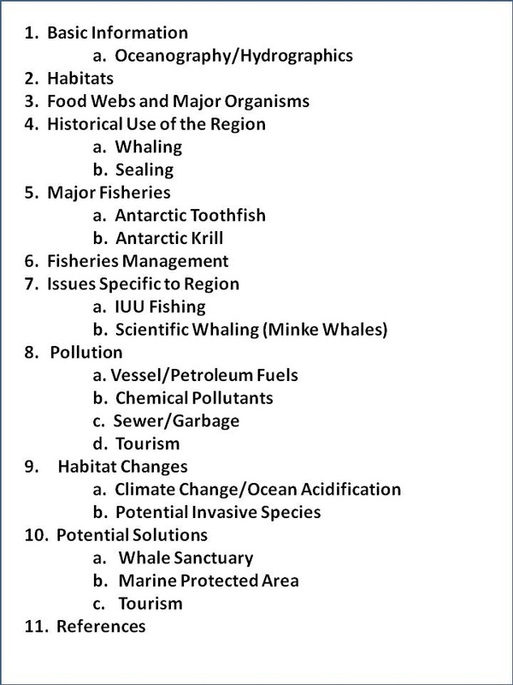
Ross Sea modified from Wikipedia map [64]
Location: Next to the continent of Antarctica
(3500 km south of New Zealand)
Surface Area: 960,000 square km
Average depth: 500-1000 m
Max. depth: <1000 m
The Ross Sea is a deep embayment in the Southern Ocean in Antarctica, which includes the waters overlying the continental shelf and slope extending from Cape Adare, Victoria Land (71◦17 S, 170◦ 14 E), to Cape Colbeck,Marie Byrd Land (71◦07 S, 157◦ 54 W) [2]. There are two main islands in the Ross Sea: to the west is Ross Island, which contains Mt. Erebrus the volcano, and to the east is Roosevelt Island. The most southern part of the Ross Sea is covered by the Ross Ice Shelf and at it's edge is the Bay of Whales. The Ross sea also contains two permanent year around bases, the McMurdo Sound and Scott Base [24].
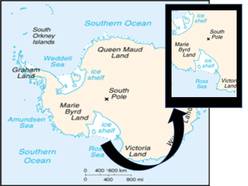
Fronts and surface water circulation in the Ross Sea.
Oceanography/Hydrographics
The topography of the sea floor is divided into an east and west side at the 180 degree Meridian. The west part is broad and less then 900 meters deep, with some shoals to less than 300 meters deep. The east part reaches to depths of about 500 meters deep.
Three main oceanic-fronts occur within the Ross Sea: the Antarctic Divergence, the Antarctic Convergence and the Antarctic Slope Front. The fronts create walls between water masses of different salinity, temperature and biota. These fronts provide minerals and nutrients which are fundamental to biological production [2].
Habitats
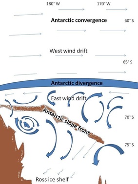
Ross Ice Shelf [3]
The biodiversity in the Ross Sea is primarily dependent on the habitat provided by the Ross Ice Shelf. The Ross Ice Shelf is the largest ice shelf in Antarctica. It is roughly 487,000 square kilometers and about 800 kilometers across. The vertical height of the shelf is between 15 and 50 meters above the sea water surface. Continuous cycling of the water under the ice shelf provide habitat for the organisms which live on, under and in the ice [2]
Another important feature to the biodiversity within the Ross Sea which provides an important habitat are the upwelling regions. Upwelling is an oceanographic phenomenon which involves wind driven motion of cooler, denser nutrient rich waters toward the sea surface and replaces the nutrient depleted surface waters. Upwelling regions promote positive primary productivity areas (phytoplankton blooms) allowing for a great diversity in organisms. Antarctic Convergence and Antarctic Divergence zones are both regions of high upwelling.
Another important feature to the biodiversity within the Ross Sea which provides an important habitat are the upwelling regions. Upwelling is an oceanographic phenomenon which involves wind driven motion of cooler, denser nutrient rich waters toward the sea surface and replaces the nutrient depleted surface waters. Upwelling regions promote positive primary productivity areas (phytoplankton blooms) allowing for a great diversity in organisms. Antarctic Convergence and Antarctic Divergence zones are both regions of high upwelling.
Food Webs and Major Organisms
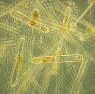
Diatoms from Antarctic Sea Ice [4]
Primary producers (phytoplankton) in the lower trophic levels include the diatoms, haptophytes, dinoflagellates and cryptophytes, but more importantly the smaller components of the microbial food web from tropical and subtropical regions are absent. This causes the mean size of the average primary producer to be larger, therefore increases the net transfer to the higher trophic levels.
Due to the large amounts of sea ice present in the Ross Sea, cryophilic algae are an important source of organic matter for the food web. Ice algae cycles are different then that of phytoplankton blooms with the seasonal increase and release into the water column occurring prior to that of the phytoplankton [5].
Similarly, the grazer crystal krill is considered to be an obligate ice form, but nearly nothing is known about its quantitative relationships with the ice algae in the Ross Sea. Crystal krill are presumed to be an major link between the ice and the water column, owing their prominence in the diets of species within the upper trophic levels [5].
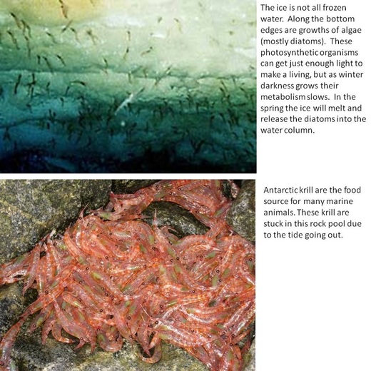
Ice algae [65]and krill [58]
This food web (below) from the Ross Sea was largely placed together by reviewing studies of diets of organisms as well as the distributions of predators and prey.
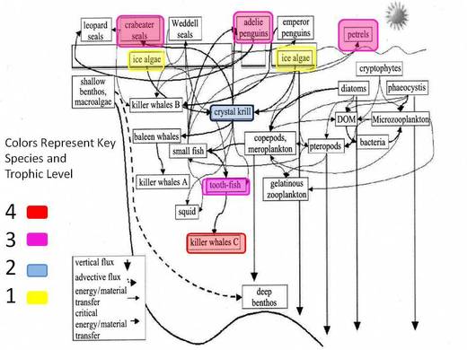
Ross Sea Food Web Modified from Smith et al. [5]
Below is a list of key species within the food web and basic data about each of the organisms.
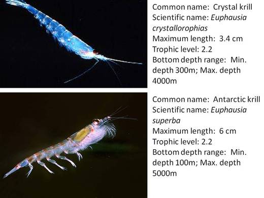
Antarctic Krill [66] and Crystal Krill [8]

Antarctic Toothfish [10] and Antarctic Silverfish [10]
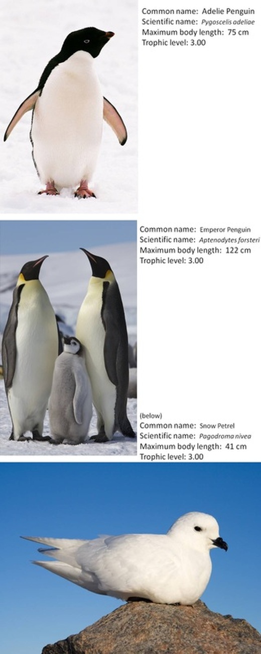
Emperor Penguins [11], Adelie Penguin [67], Snow Petrel [68]
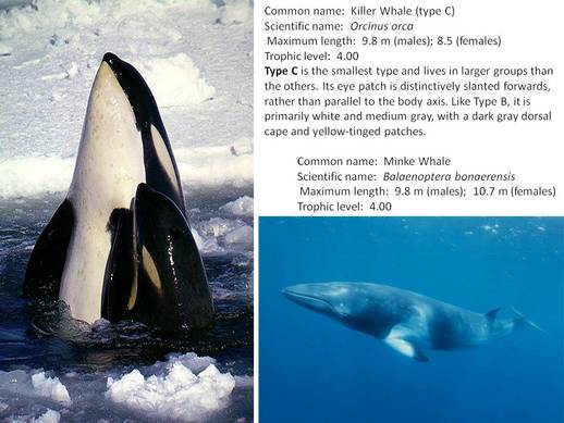
Killer Whale [13 ] and Minke Whale [9]
Historical Use of the Region
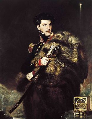
James Ross [7]
The first ships to enter the sea were the HMS Erebus and Terror, commanded by Royal Naval Captain James Clark Ross in 1842 [14]. From the end of the 19th century till the early 1920s, has been deemed the Heroic age of Antarctic exploration. During this period the Antarctic continent became the focus of international effort in geographical exploration and scientific research. The label “heroic” was bestowed later to recognize those who were the pioneers of Antarctica. Expedition leaders during the Heroic age of Antarctic exploration include Ernest Shackleton, Roald Amundsen, Douglas Mawson and Robert Falcon Scott [19]. The Anglo-Irish explorer, Sir Ernest Henry Shackleton sailed for the Antarctic on a ship called the Nimrod in 1908. After a period of time, Shackleton and crew found the Barrier Inlet expanded to form a large bay. Within that bay were hundreds of whales. This bay was to be christened the name Bay of Whales [20]. The Norwegian explorer, Roald Engelbregt Gravning Amundsen, led the first Antarctic expedition to reach the South Pole. The expedition arrived at the eastern edge of the Ross Ice Shelf at the Bay of Whales. In 1911, Amundsen located his base camp there and called it Framheim. He then started his South Pole expedition from the Bay of Whales in 1911 [18]. The Bay of Whales was the most used anchorage in the Ross Sea for about 50 years until it broke off the ice shelf [14].
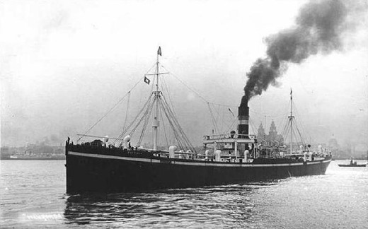
The James Clark Ross [8]
Whaling
Some of the first recorded whale sightings within the Ross Sea are from a biologist, D.G Lillie, who was aboard the Scott’s ship Terra Nova. The most common species seen were the Blue Whale and the Pike Whale. Type C killer whales, which are not whales but porpoises, were also seen. The James Clark Ross, a factory ship, tied up for several weeks within the Ross Sea during the 1923 and the 1924 whaling seasons. Shortly after, the C.A Larsen factory ship began to harvest whales. Until the cessation of industrial whaling in 1986, whalers took approximately 19,500 minke whales from the waters off Adelie Land and Ross Sea. In 1987, came the adoption of the moratorium on commercial whaling [16]. The purpose of the moratorium was to provide for the proper conservation of whale stocks and thus make possible the orderly development of the whaling industry. The moratorium was set into play by the International Whaling Commission (IWC) and has not yet been lifted [15]. In 1994 came the creation of the Southern Ocean Whale Sanctuary. The northern boundary of the sanctuary follows the 40S parallel of latitude except in the Indian Ocean where it joins the southern boundary of the Indian Ocean Whale Sanctuary [17].
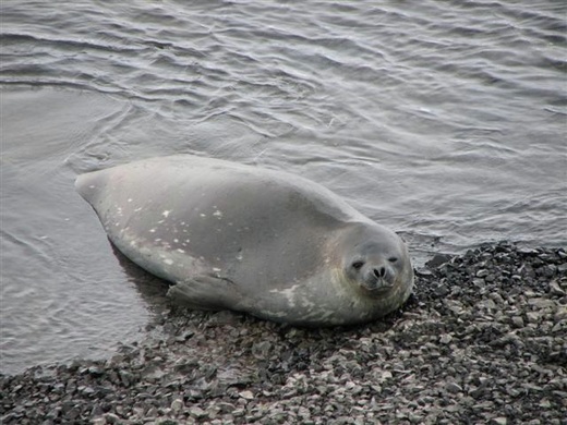
Weddell Seal [59]
Sealing
The early “heroic” expeditions killed an unknown number of Weddell seals for human and dog food in the southern McMurdo Sound. In the same area, the New Zealand Antarctic Program killed 50-100 annually in order to feed sled dogs, approximately 2000 animals’ total. From 1957 to 1985, the United States Program killed a small unknown number for scientific reasons. The population in the late 1950s was thought to be around 3000 individuals. By the mid- 1980s the killing ended [16].
The early “heroic” expeditions killed an unknown number of Weddell seals for human and dog food in the southern McMurdo Sound. In the same area, the New Zealand Antarctic Program killed 50-100 annually in order to feed sled dogs, approximately 2000 animals’ total. From 1957 to 1985, the United States Program killed a small unknown number for scientific reasons. The population in the late 1950s was thought to be around 3000 individuals. By the mid- 1980s the killing ended [16].
Major Fisheries
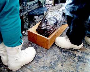
Antarctic Toothfish [69]
Antarctic Toothfish
The most valuable fishery object in the Ross Sea is the Antarctic toothfish. Antarctic toothfish Dissostichus mawsoni belong to the bathypelagic species of the family Nototheniidae. The bathypelagic zone is the pelagic zone which extends from a depth of 1000 to 4000 m. Their distribution is at high latitudes of waters off continental Antarctic regions [27]. Antarctic toothfish slow growth rates and they are long lived, about 50 years. They reach maturity between the ages of 8-10 years [26]. Mature individuals stay at higher depths (600-1800 m) until they are ready for spawning and feeding migrations. They will then drop to depths greater than 2000 meters [27].
Antarctic toothfish are mainly caught using longline fishing. Longline fishing uses a long main line with baited hooks attached at various intervals which branch off of the main line [25]. New Zealand initiated longline fishing of Antarctic toothfish in the fishing season of 1997-1998. As other countries joined the fishery the annual volumes of Antarctic toothfish catch increased. During recent years the total catch is at a level of 2.7-3.1 thousand tonnes annually. During the 2002-2003 fishing season, the Russian catch of this species reached a maximum of 703 t [27]. During the 2005-2006 fishing season, CCAMLR reported a catch of 16,843 tonnes caught in Antarctic waters.
The Antarctic toothfish is certified by the Marine Stewardship Council (MSC) as “certified sustainable seafood.” This certification is disputed by Greenpeace, the Pew Environment Group and Antarctic Southern Ocean Coalition (ASOC) [28, 29]. The MSC label certifies to consumers that the fishery which caught it is environmentally friendly, meaning the fishing operation works to avoid ways that may jeopardize the stocks. The disputers argue that the certification wasn’t justified because of a shortage of key data, such as the ecosystem effects of fishing and how the size of the stock has changes over the past few years [29]. Fish certified as sustainable, such as true Chilean sea bass, can fetch higher prices on the market. Greenpeace states that due to the fishes biology this fish species is highly vulnerable to exploitation. Fifteen of the United States largest retailers sell the Antarctic toothfish and most of it is packaged as Chilean sea bass. Other names include White cod, Merluza negra and Mero [26, 28]. Antarctic toothfish are a highly sought species in the world fish market.
Antarctic krill [12]
Antarctic Krill
Giant aggregations of krill, a small crustacean, swim near the ocean’s surface making them easy to catch in large numbers.They are semi-transparent and about 4-5 cm in length when fully grown. Their lifespan is approximately 6 years [38]. Most fisheries catch them by trawling at low speeds. Trawling is a method which involves pulling a large fishing net behind one or more boats. Commercial krill fishing initially began in the 1972-1973 fishing season and has expanded rapidly. In the first decade of krill fishing, most of the krill was largely used for animal feed and fertilizer. In the mid-1980s, difficulties with the processing of krill became overcome and uses for krill expanded. Much of today’s krill is used for aquaculture feed, human consumption and bait. Other uses include nutritional products such as omega-3 fatty acid supplements and even some cosmetics [30].
In 2009, Aker Biomarine, an Oslo-based company who specializes in harvesting and processing Antarctic krill, upgraded its harvesting vessel to boost its catch [31]. The Antarctic krill are no match for this commercial vessel. It is a floating factory, employing sophisticated methods to catch, process and flash freeze the krill. The new equipment enables it to continuously vacuum millions of krill from the ocean [37]. In the first half of 2010 it produced 8,600 tonnes of krill meal for aquaculture. This total is up from the 6,200 tonnes during the whole 2009 season. The total krill catch for this season is expected to be 150,000 to 180,000 tonnes, which exceeds last year’s catch by about 40% [31]. China, for the first time, has authorized two vessels to fish for krill. Their catch for 23 days was reported at 2,000 tonnes of krill. This catch is small compared to krill catches of vessels from Japan, Korea and Norway, which is roughly about 20,000 tonnes per vessel [36]. The catch limit set by CCAMLR is 3.47 million tonnes annually in the Southern ocean [31].
Fisheries Management

CCAMLR logo [38]
Antarctica’s management has been under a treaty system for the last 50+ years. The Antarctic Treaty was signed in Washington in 1959 for the purpose of setting aside Antarctica as a region of peace and cooperation. By establishing this treaty with 47 countries, Antarctica is open for scientific studies and bans military activity on the continent. The Antarctic Treaty covers the entire continent including the ice shelves and waters around it, including the Ross Sea. The other agreements making up the Antarctic Treaty system include: the Protocol on Environmental Protection to the Antarctic Treaty: Conservation of Antarctic Flora and Fauna, the Convention for the Conservation of Antarctic Seals (CCAS) and the Convention on the Conservation of Antarctic Marine Living Resources (CCAMLR). Although the CCAMLR and CCAS are independent agreements, they contain provisions committing their establishment to honor the original Antarctic Treaty [21].
CCAMLR manages its fisheries in what has become known as the ecosystem approach. The ecosystem approach does not concentrate on just the species fished but also seeks to minimize the risk imposed by the fisheries on the ecosystem as a whole. To make this a workable approach, CCAMLR sets out general conservation objectives that embody important principles for the regulation of fisheries.
CCAMLR is divided into different management bodies: the Secretariat, the Commission and the Scientific Committee. Each management body performs a variety of functions to manage CCAMLR efficiently and effectively (for a list of management practices click here).
The Secretariat supports the meetings of CCAMLR and the daily functions arising from the work of the Scientific Committee and the Commission. The Commission has been the forefront of the organizations ecosystem approach to managing resources and the development of the regulatory framework to manage each fishery. The Commission has developed measures to deal with IUU fishing (Illegal Unregulated and Unreported fishing) in the Ross Sea and waters around Antarctica. The Commission also determines fisheries catch levels, mostly through the advice received from the Scientific Committee. The Scientific Committee provides consultation, based on information from scientific studies, to the Commission. In order to carry out this function, in 1985 the CEMP was established (CCAMLR Ecosystem Monitoring Program). CEMP’s major function is to monitor the key life history parameters of indicator species who respond to changes in the availability of harvested species [26].
Issues Specific to Region
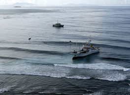
Fishing vessel [70]
IUU Fishing
Illegal, unreported and unregulated (IUU) fishing has not been a major problem within the Ross Sea historically, but it has increased since the value of the Antarctic toothfish has sky rocketed. The most recent estimate for levels of IUU fishing in CCAMLR areas for the 2008-2009 fishing season is 938 tonnes [43]. A range of steps have been taken to discourage IUU fishing in the Ross Sea over the last few seasons [40]. As a tool to fight the IUU fishing, enhanced port state control has gained ground throughout the last few years. In 2009, the United Nations(UN) and the Food and Agriculture Organization (FAO) developed a Port State Measures Agreement. Port State Measures (PSM) are requirements established which require foreign fishing vessels to follow in order to use ports within a port state [42]. Fifteen states and the European Union have signed on to the agreement and represent a standard to harmonize and strengthen port state controls globally [43]. The PSM is one way which states and organizations can work to stop IUU fishing.
CCAMLR, in common with other international agreements, does not impose regulations but attempts to reach agreements on issues which members of the Convention are obligated to implement. CCAMLR has many strict vessel requirements for fishing vessels to follow in order to fish within the Convention area. These requirements include things such as proper marking so they can be readily identified and recognized according to FAO Standard Specifications and continuous monitoring of vessels position using an automated satellite-linked monitoring system (VMS). (For a complete list of requirements click here.)
In 2000, CCAMLR introduced the CDS (Catch Documentation Scheme) to track the landings and trade flows of toothfish caught within the Convention Area, as well as in the adjacent waters [26]. When a fishing vessel is found to be non-compliant either by the PSM or CDS, action is taken up with the vessels Flag state. The Secretariat uses reports of non-compliant vessels to compile an IUU-list. A fishing vessel can be added to the list if there is evidence that the vessel has violated the agreement. The Flag state in which the vessel belongs, then must follow up within a certain time allotment with the Secretariat as to the outcome of the violation. These violations are then discussed at the annual meetings of CCAMLR’s Commission. When a vessel is added to the IUU-list, the Secretariat will circulate a copy to all state ports. If a vessel is listed, then the state port can deny the vessel access for all support functions including non-emergency refueling, resupplying and repairs. The state port can also confiscate the catch and all imports, exports and re-exports from the vessel are prohibited. Shippers are encouraged not to transship catch of vessels listed on the IUU-list [39].
Many areas have begun to implement the protocol to stop IUU fishing activities, including New Zealand which contributes practical support to CCAMLR areas. This support includes aerial patrolling of the Ross Sea and inspection of vessels entering the port of New Zealand. Inspections and aerial patrols have been successful on a number of occasions. As a result fishing vessels such as the Paloma V and Carmela, formally Gold Dragon, were added to the IUU-list [40, 41].
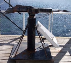
Whaling Harpoon [32]
Scientific Whaling (Minke Whales)
Whaling is conducted under Article VIII from the moratorium which allows for ‘scientific whaling’ [23]. Subsistence whaling by aboriginal peoples is also allowed. The numbers of whales allowed for subsistence whaling are set by the IWC [22]. Three nations including Iceland, Norway and Japan still continue to engage in whaling. Last year approximately 1,700 whales were killed [36]. During the 2004-2005 seasons JARPA (Japanese Whale Research Program under special permit in the Antarctic) increased their take for research purposes to 300 (+ or – 10%) Minke whales and then again has recently increased their take to 850 Minke whales.
The taking of these whales is under great dispute from various countries including Australia, who has recently taken Japan in front of the International Court of Justice. Australia proposes that Japan has breached and continues to breach the obligation to observe the zero catch limit in relation to killing of whales for commercial purposes and to refrain from taking whales within the Southern Ocean Sanctuary [22]. Currently the IWC is still working to solve the problems incurred by the moratorium, including discussions of lifting it under certain conditions. The Pew Environment Group, the WWF, Greenpeace and New Zealand have supported the compromise conditions set forth by the IWC [35]. Some of these compromise conditions include a set number of allowances to permit them to whale commercially, involving a yearly quota of whale catches which would also require an international observer on board and the start of a DNA registry of whale meat in order to track whales caught and sold illegally [34].
The Austrailian and New Zealand science communities are continuing whaling research in a non-lethal way. This team of scientists is working on studying population structure, distribution, movement patterns and environmental linkages of the whales within the Southern Ocean [33].
Pollution
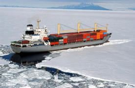
Shipping Vessel in McMurdo Sound [73]
Vessel/Petroleum Fuels
Vessels traveling through Antarctica face extreme weather conditions and large amounts packed ice. Two recent vessel accidents, the Ocean Nova in 2009 and the MS Explorer in 2007, are proof of these conditions [44, 46]. Larger ships present a significant risk because of the amount of fuel they carry. The MS Explorer was carrying an estimated 210 cubic meters of lubricants and petroleum when it collided. When the Chilean naval icebreaker arrived on the scene, it was stated they traveled over a visible oil slick. When the MS Explorer finally sank, a visible trail of iridescent oil sheen covering 2.5 km squared was observed. After two days, the sheen had been reported to cover an area of 5 km squared. Subsequent reports were received from the Chilean Navy expressing that the sheen continued to be seen in the vicinity of where the boat had sank. It was determined to be from the slow and steady release of fuel from one or more of the tanks onboard the vessel [44]. Recent survey work of a seabed near McMurdo sound revealed 603 fuel drums. In 2003, ice conditions blocked a United States tanker from reaching the harbor at McMurdo Station. Shore workers had to rig a temporary 5.6 km fuel line over the pack ice in order to discharge the ship’s cargo, during which it pumped more than 6 million gallons of fuel to the storage facilities at McMurdo [45].
Vessels traveling through Antarctica face extreme weather conditions and large amounts packed ice. Two recent vessel accidents, the Ocean Nova in 2009 and the MS Explorer in 2007, are proof of these conditions [44, 46]. Larger ships present a significant risk because of the amount of fuel they carry. The MS Explorer was carrying an estimated 210 cubic meters of lubricants and petroleum when it collided. When the Chilean naval icebreaker arrived on the scene, it was stated they traveled over a visible oil slick. When the MS Explorer finally sank, a visible trail of iridescent oil sheen covering 2.5 km squared was observed. After two days, the sheen had been reported to cover an area of 5 km squared. Subsequent reports were received from the Chilean Navy expressing that the sheen continued to be seen in the vicinity of where the boat had sank. It was determined to be from the slow and steady release of fuel from one or more of the tanks onboard the vessel [44]. Recent survey work of a seabed near McMurdo sound revealed 603 fuel drums. In 2003, ice conditions blocked a United States tanker from reaching the harbor at McMurdo Station. Shore workers had to rig a temporary 5.6 km fuel line over the pack ice in order to discharge the ship’s cargo, during which it pumped more than 6 million gallons of fuel to the storage facilities at McMurdo [45].
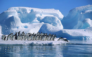
Adélie penguins [75]
Chemical Pollutants
The Southern Ocean forms boundaries between Antarctica and other bodies of water, just like in the Ross Sea. However, volatile contaminants are believed to reach the Antarctic continent through transport in air masses. Polar Regions may become the final resting place for Persistent Organic Pollutants (POP), such as PCBs. Deposited POPs become trapped in the ice and can be released into the environment as the ice melts. Then the POPs enter the food web system, first through the lower trophic levels and then into the upper trophic levels. Adélie penguins feed mostly upon the krill within the Ross Sea. However, when krill is unavailable they will include fish in their diet, such as Antarctic silverfish. Due to this fish diet, the penguins are subjected to large amounts of pollutants being passed to them through the food web. The end result is the bioaccumulation of chemicals in the upper trophic level organisms, such as Adélie penguins [47].
The Southern Ocean forms boundaries between Antarctica and other bodies of water, just like in the Ross Sea. However, volatile contaminants are believed to reach the Antarctic continent through transport in air masses. Polar Regions may become the final resting place for Persistent Organic Pollutants (POP), such as PCBs. Deposited POPs become trapped in the ice and can be released into the environment as the ice melts. Then the POPs enter the food web system, first through the lower trophic levels and then into the upper trophic levels. Adélie penguins feed mostly upon the krill within the Ross Sea. However, when krill is unavailable they will include fish in their diet, such as Antarctic silverfish. Due to this fish diet, the penguins are subjected to large amounts of pollutants being passed to them through the food web. The end result is the bioaccumulation of chemicals in the upper trophic level organisms, such as Adélie penguins [47].
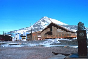
National Science Foundation building in McMurdo Station [74]
Sewer/Garbage
The operation of two year around bases by the United States and New Zealand has left severe pollution damage to McMurdo Sound’s pristine environment. McMurdo Station residents discarded their garbage out to the sea ice until 1981. According to news reports, the garbage would sink to the sea floor once the warmer spring conditions brought the melting of the ice. Modern operations in McMurdo Sound have sparked cleanup efforts, including exporting trash and contaminates by ship and recycling. By 2003, the United States Antarctic Program reported it is recycling about 70% of its wastes [45].
In McMurdo station, wastewaters were discharged into the cold marine waters through direct pipeline. High densities of coliform bacteria were found along the shoreline, where the plume extended 200-300 meters seaward [47]. Thousands of gallons of raw sewage was dumped directly into the sound up until 2003, when a waste treatment plant was initiated [45].
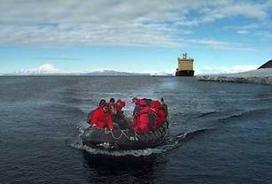
Visitors from a tourist ship make their way to McMurdo ice pier [72]
Tourism
It is easy to understand the touristic appeal to Antarctica. From the magnificent icebergs to the majestic whales, it is one of the world’s most pristine places. Tourism began in the late 1950s and has stayed at low levels until recent years. Recent totals from one base show that in the 1990-1991 summer season, 4,698 tourists visited. That number increasing in the 2007-2008 summer season to 46,069 [49]. Cruises, including up to 960 tourists, have traveled on voyages to the Ross Sea since 1992 [45].
Tourist time in Antarctica is shorter, but it means many more people within that short of time. Tourism has exploded in Antarctica with aqualungs, parachutes, motorbikes, aircraft and all-terrain vehicles. Large numbers of people now travel to see the historic sites and key wildlife scenes [49]. The International Association of Tour Operators (IAATO) have established standards to keep tourists from bothering wildlife, but large ships carrying more than 400 passengers may spend many hours transporting tourists through breeding sites. Land based tourism in Antarctica does continue to be rare, despite the large amounts of tourism happening there [45].
Habitat Changes
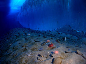
Bottom waters in McMurdo Sound [80]
Climate Change/Ocean Acidification
Satellite Passive Microwave technology has sea ice imagery available that allow good depictions of the Ross Sea. This data has been kept since 1978 and allows for calculations of trends in the ice cover. On an annually basis, the Ross sea average ice cover is increased at a rate of 12,600 (+/-) 1.6% per decade. This places the Ross Sea at the highest rate of increase in sea ice coverage within the Southern Ocean [79].
Climate Change is a long term change in weather conditions which have an effect on the Earth. Ross Sea is one area of the Earth which will show changes due to this issue. Ocean acidification can work in conjunction with climate change and have an effect on the Ross Sea, in addition to just climate change alone. Ocean acidification is the decrease in the pH of the Earth’s oceans caused by the uptake of carbon dioxide from the atmosphere, either from natural causes or anthropogenic causes. Acidification from global air pollution, combined with lower temperatures and lower salinity due to ice melt, has been associated with changes in phytoplankton. When conditions are normal, diatoms are the dominant phytoplankton in the Ross Sea. However, with the combination of climate and acidification changes, cryptophytes which are much smaller then diatoms tend to run in higher abundances and out-compete the regular phytoplankton. The cryptophytes are so much smaller that the krill do not feed upon them causing changes in the food web, especially for the krill. Krill are of major importance in the Ross Sea food web and changes in the krill’s diet can have devastating effects on higher trophic organisms [77].
Ocean acidification has effects on other organisms within the Ross Sea. For shell forming organisms, the increase of carbon dioxide concentration in the sea causes a reduction in the amount of available carbonate. Carbonate is used by the organisms to form their external hard shell, which is a necessity for the survival of these creatures [78].
Potential Invasive Species
A recent study suggests that king crabs, who are voracious predators, could potentially be able to enter into areas which physiological stresses have kept them from before, including possibly the Ross Sea. The reason behind this is global warming, which could potentially cause increased water temperatures. King crabs occur most often at locations where the polar water temperatures are relatively warm. Temperature has been determined to be the limiting factor for distribution, the lowest temperature being between 0.4 and 0.5°C, suggesting a thermal barrier.
With global warming increasing the water temperatures, even a small increase, could lead to king crabs moving into the new areas. This could have considerable ecological consequences because king crabs are such rapacious predators that crush their prey then feed on it. The king crabs could potentially out-compete the other predators in the sea. So their overall predatory nature could cause havoc within this ecosystem [81].
Potential Solutions
Whale sanctuary
The IWC established a whale sanctuary in the Southern Ocean in 1994. Commercial whaling is not allowed, however the ‘scientific whaling’ exemption has allowed for whales to continue being hunted in this area. Countries seeking scientific whales in this loophole have used their population size to argue that there is no reason to disallow small scale harvesting of whales. The whale sanctuary should be just what it is called, a place where whales are allowed to be without be harvested.
The IWC should arrange for a long term non-lethal program to research, study and monitor changes in the whales within the Southern Ocean ecosystem. Tracking the expected recovery rates of whale populations under the zero catch limits and monitoring for changes in populations would also be important information to study. The IWC should request all scientific data, which was obtained through all the scientific permits issued to the other countries. With all of the information that can be obtained from the past studies and all the future ones, we can obtain enough information to one day bring the whale populations to a stable level.
Marine Protected Area
The Ross Sea, one of the world’s most pristine pieces of ocean is under increasing threat from marketable interests. The Ross Sea should be designated as a Marine Protected Area. A Marine Protected Area is defined as a “geographical space, recognized, dedicated and managed, through legal or other effective means, to achieve means, to achieve the long-term conservation of nature with associated ecosystem services and cultural values”[76]. The oceans need more MPAs if they are to be protected from pollution, overfishing and invasive species. With the Ross Sea’s incredible biological diversity and long history it is important to protect it in order to avoid any more exploitation. It is extremely difficult to reverse the damage once it has been done and by designating the Ross Sea as an MPA, it could stay pristine.(click here to review the proposed Ross Sea MPA)
Tourism
Currently, tourism is something that is not regulated in the Antarctic system. Regulating tourism to secure the environment and protect the stability of Antarctica should be considered. The ASOC, with the help from other foundations was able to launch the Antarctic Tourism Campaign to focus public awareness of the issues caused by tourism [49]. There must be some limitations to tourism because of the impact human activities have on an ecosystem.
Works Cited/Image References
[2] Knox, George (2007) Biology of the Southern Ocean. CRC Press, New Zealand. Pp.13-14.
[5] Smith, Walker, Ainley David and Cattaneo-Vietti Riccardo (2007) Trophic interactions within the Ross Sea continental shelf ecosystem. Philosophical Transactions of The Royal B Society 362:95-111.
[6] Sea Around Us. <http://www.seaaroundus.org> 02 November, 2010
[14] Trewby, Mary (2002) Antarctica an Encyclopedia from Abbott Ice Shelf to Zooplankton. Natural History.
[15] International Whaling Commision. <http://iwcoffice.org/> 06 November, 2010
[16] Ainley, David (2010) A history of exploitation of the Ross Sea, Antarctica. Polar Record 238:233-243.
[17]Wikipedia. Southern Ocean Whale Sanctuary. <http://en.wikipedia.org/wiki/Southern_Ocean
_Whale_Sanctuary> 06 November, 2010
[18] Wikipedia. Roald Amundsen. <http://en.wikipedia.org/wiki/Roald_Amundsen> 06 November, 2010
[19] Wikipedia. Heroic Age of Antarctic Expedition. <http://en.wikipedia.org/wiki/Heroic_Age_of_Antarctic_
Exploration> 06 November, 2010
[20] Wikipedia. Ernest Shackleton. <http://en.wikipedia.org/wiki/Ernest_Shackleton> 06 November, 2010.
[21] Secretariat of the Antarctic Treaty System. The Antarctic Treaty. < http://www.ats.aq/e/ats.htm> 20 November, 2010.
[22] Rothwell, Donald R. (2010) Australia v. Japan: JARPA II Whaling Case before the International Court of Justice.
[23] International Whaling Commission. IWC information. <http://www.iwcoffice.org/commission/iwcmain.htm> 15 November, 2010.
[24] Encyclopedia (1995) American International Education. Groiler Inc. Danbury, Conneticut
[25] Wikipedia. Longline fishing. <http://en.wikipedia.org/wiki/Longline_fishing> 09 November, 2010.
[26] CCAMLR. < http://www.ccamlr.org/default.htm> 09 November, 2010.
[27] Piyanova, S.V., Kokorin N.V. (2010). Cytomorphology of Female and Male Gonads in Antarctic Toothfish Dissosctichus mawsoni (Nototheniidae) from the Ross Sea in the Summer Period. Journal of Ichthyology. (50)5:374-385.
[28] Greenpeace International. Press Releases. Greenpeace calls on the Seafood Industry to help save the Ross Sea. <http://www.greenpeace.org/international/en/
press/releases/Greenpeace-calls-on-the-Seafood-
Industry-to-help-save-the-Ross-Sea/> 07 November, 2010.
[29] Stokstad, Erik (2010). Behind the Eco-Label, a Debate Over Antarctic Toothfish. Science. 329:1596-1597.
[30] Kock, Karl-Hermann (2000). Understanding CCAMLR’s Approach to Management. <http://www.ccamlr.org/pu/E/e_pubs/am/am-all.pdf> 09 November, 2010.
[31]Schiermeier, Quirin (2010). Ecologists fear Antarctic krill crisis. Nature. (467)15 <http://www.nature.com/news/2010/100901/full/
467015a.html> 09 November, 2010.
[33] Australian Antarctic Division: Leading Australia’s Antarctic Program. Non-lethal Whale Research Reaps Rewards. <http://www.antarctica.gov.au/media
/news/2010/non-lethal-whale-research-reaps-rewards> 15, November 2010. [34] Time. Could Lifting the Whaling Ban Save the Whales? <http://www.time.com/time/health/article/
0,8599,1983995,00.html> 15 November, 2010.
[35] Environment news service. Global Whaling Moratorium Stands as IWC Compromise plan. <http://www.ens-newswire.com/ens/jun2010/
2010-06-23-01.html> 15, November 2010.
[36] Barnes, James (2010). Antarctic Krill Report. Antartic and Southern Ocean Coalition. <http://www.asoc.org/LinkClick.aspx?fileticket=gxeg-3YkMpw%3d&tabid=78> 09 November, 2010.
[37] Antarctic Krill Conservation Project. Increasing Demand for Krill. <http://www.krillcount.org/issues.html> 09 November, 2010
[39] CCAMLR. Schedule of Conservation Measures in Force 2009/10 Season (As amended by the Commission at the Twenty-eighth Meeting 26 October to 6 November 2009). <http://www.ccamlr.org/pu/E/e_pubs/cm/09-10/all.pdf> 20 November, 2010.
[40] Ministry of Fisheries. Fishing in the Ross Sea. <http://www.fish.govt.nz/en-nz/International/Fishing+in+the+Ross+Sea.htm> 20 November, 2010.
[41] MERCO press. NZ intercepts pirate tooth-fish long-liner “Carmela” in the Ross Sea. <http://en.mercopress.com/2009/12/20/nz-intercepts-pirate-tooth-fish-long-liner-carmela-in-the-ross-sea> 20 November, 2010.
[42]FAO. Fishery Port State Measures. <http://www.fao.org/fishery/psm/en> 20 November, 2010.
[43] ASOC Secretariat. Antarctic and Southern Ocean Coalition Press Briefing for 2010 Meeting of the Commission on the Conservation of Antarctic Marine Living Resources <http://www.asoc.org/LinkClick.aspx?fileticket=XQfFg_M4zro%3D&tabid=36> 20 November, 2010.
[44] Decision of the Commisioner of Maritime Affairs, R.L. (2007) Report of Investigation in the Matter of Sinking of Passenger Vessel Explorer (O.N. 8495). <http://www.asoc.org/Portals/0/Explorer%20-%20Final%20Report.PDF> 20 November, 2010.
[45] Wikipedia. McMurdo Sound.<http://en.wikipedia.org/wiki/McMurdo_Sound> 22 November, 2010
[46] Cruise Bruise. Ocean Nova Grounding. <http://www.cruisebruise.com/Ocean_Nova_Grounding_February
_17_2009.html> 22 November, 2010.
[47] Corsolini Simonetta, Nicolettaademollo, Romeo Teresa, Olmastroni Silvia and Focardi Silvano. (2003). Persistent organic pollutants in some species of a Ross Sea pelagic trophic web. Antarctic Science 15(1):95-104.
[48] Bruni V. Maugeri L, and Monticelli L. (1997) Faecal Pollution Indicators in Terra Nova Bay (Ross Sea, Antarctica). Marine Pollution Bulletin. (34) 11:908-912.
[49] Antarctic Southern Ocean Coalition. Regulating Antartic Tourism. <http://www.asoc.org/AntarcticAdvocacy/CampaignstoProtect
Antarctica/RegulatingAntarcticTourism.aspx> 22 November, 2010.
[76] Antarctic Southern Ocean Coalition. Marine Protected Areas. <http://www.asoc.org/AntarcticAdvocacy/CriticalIssues/
MarineProtectedAreas/tabid/176/Default.aspx> 23 November, 2010.
[77] Antarctic Southern Ocean Coalition. Krill and Climate Fact Sheet. <http://www.asoc.org/Portals/0/AKCP%20Krill-Climate%20Factsheet.pdf> 24 November, 2010.
[78] Antarctic Southern Ocean Coaliton. Climate Change. <http://www.asoc.org/AntarcticAdvocacy/CriticalIssues/
ClimateChange/tabid/76/Default.aspx> 24 November, 2010.
[79] Parkinson, Claire L. (2009) The Satellite Passive-Microwave Record of Sea Ice in the Ross Sea since Late 1978. The Ross Sea, Antarctica: Science, Policy and the Public in a Pristine Marine Ecosystem. <http://www.asoc.org/Portals/0/IMCC%20Ross%20Sea%20Final%20Report-1.pdf> 24 November, 2010.
[81} Duff, Andrew (2010) King Crab Invasion Threatens Antarctica. Earth & Environment. <http://www.futurity.org/earth-environment/king-crab-invasion-threatens-antarctica/> 06 December, 2010.
Image References
[1] http://www.photoglobe.info/earth_from_space/
spc_antarctic_ross.html
[3] http://www.mbari.org/benthic/images/Antslides/ice%20shelf.jpg
[4] http://www.acecrc.sipex.aq/access/page/?page=80
[9] http://www.reefteach.com.au/images/
Minke_Whales.jpg
[10] http://www.sciencelearn.org.nz/
[11] http://commons.wikimedia.org/wiki/Main_Page
[12] http://commons.wikimedia.org/wiki/File:Kilsheadkils.jpg
[13] http://commons.wikimedia.org/wiki/File:Type_C_
Orcas.jpg
[7] http://commons.wikimedia.org/wiki/File:James_
Clark_Ross.jpg
[8] http://www.rrsjamescook.com/History%20-%
20DiscoveryExpo.asp?Back=index.asp
[32] http://commons.wikimedia.org/wiki/File:Whaling_
harpoon.jpg
[38] http://firms.fao.org/firms/partners/en
[51] http://commons.wikimedia.org/wiki/File:B%C3%A9b%C3%A9_Phoque_de_Weddell_-_Baby_Weddell_Seal.jpg
[52] http://photolibrary.usap.gov/Portscripts/PortWeb.dll?query&field1=Filename&op1=matches&value=MINKE.1.
JPG&catalog=Antarctica&template=USAPgovMidThumbs
[53] http://photolibrary.usap.gov/Portscripts/PortWeb.dll?query&field1=Filename&op1=matches&value=ICEBERG
_CLOSE.JPG&catalog=Antarctica&template=USAPgov
MidThumbs
[54] http://photolibrary.usap.gov/Portscripts/PortWeb.dll?query&field1=Filename&op1=matches&value=ICEBERG
_CLOSE.JPG&catalog=Antarctica&template=USAPgov
MidThumbs
[55] http://photolibrary.usap.gov/Portscripts/PortWeb.dll?query&field1=Filename&op1=matches&value=SEALS_
CRABBIES.JPG&catalog=Antarctica&template=USAPgo
vMidThumbs
[56] http://photolibrary.usap.gov/Portscripts/PortWeb.dll?query&field1=Filename&op1=matches&value=EREBUSC
HANNEL.JPG&catalog=Antarctica&template=USAPgov
MidThumbs
[57] http://photolibrary.usap.gov/Portscripts/PortWeb.dll?query&field1=Filename&op1=matches&value=SEAICE.
JPG&catalog=Antarctica&template=USAPgovMidThumbs
[58] http://photolibrary.usap.gov/Portscripts/PortWeb.dll?query&field1=Filename&op1=matches&value=KRILL_
POOL.JPG&catalog=Antarctica&template=USAPgov
MidThumbs
[59] http://photolibrary.usap.gov/Portscripts/PortWeb.dll?query&field1=Filename&op1=matches&value=WEDDELL
2010.JPG&catalog=Antarctica&template=USAPgovMid
Thumbs
[60] http://commons.wikimedia.org/wiki/
File:Krabbenfresser.jpg
[61] http://commons.wikimedia.org/wiki
/File:Emperor_Penguin_Ponders.jpg
[62] http://photolibrary.usap.gov/Portscripts/PortWeb.dll?query&field1=Filename&op1=matches&value=CHINS
TRAPSWIM.JPG&catalog=Antarctica&template=USAPg
ovMidThumbs
[63] http://commons.wikimedia.org/wiki
/File:Dmawsoni_Head_shot.jpg
[64] http://commons.wikimedia.org/
wiki/File:Antarctica_Map.png
[65] http://commons.wikimedia.org/wiki/
File:Krillicekils.jpg
[66] http://commons.wikimedia.org/wiki/File:Krillkils.jpg
[67] http://commons.wikimedia.org/wiki/File:Adelie
pinguin-01.jpg
[68] http://commons.wikimedia.org/wiki/File:P%C3%A9trel_des_neiges_-_Snow_Petrel.jpg
[69] http://commons.wikimedia.org/wiki/
File:Antarctic_cod.jpg
[70] http://commons.wikimedia.org/wiki/File:Solomon
_Island_Police27s_patrol_boat_Lata_rescuing_
fishing_vessel.jpg
[71] http://photolibrary.usap.gov/Portscripts/PortWeb.dll?query&field1=Filename&op1=matches&value=MOM
BABY2.JPG&catalog=Antarctica&template=USAPgovMid
Thumbs
[72 ]http://photolibrary.usap.gov/Portscripts/PortWeb.dll?query&field1=Filename&op1=matches&value=TOURISM.
jpg&catalog=Antarctica&template=USAPgovMidThumbs
[73] http://commons.wikimedia.org/
wiki/File:MV_American_Tern_(T-AK_4729)_in_McMurdo_Sound_-d.jpg
[74] http://commons.wikimedia.org/wiki
/File:Mcmurdo-station.jpg
[75] http://photolibrary.usap.gov/Portscripts/PortWeb
.dll?query&field1=Filename&op1=matches&value=
CROZIERADELIE2.JPG&catalog=Antarctica&
template=USAPgovMidThumbs
[80] http://commons.wikimedia.org/wiki/
File:Underwater_mcmurdo_sound.jpg
[82] http://photolibrary.usap.gov/
Portscripts/PortWeb.dllquery&field1=Filename&
op1=matches&value=RED_SPT.JPG&catalog=
Antarctica&template=USAPgovMidThumbs
[83] http://photolibrary.usap.gov/Portscripts/PortWeb
.dllquery&field1=filename&op1=matches&value=
Eastwind.jpg&catalog=Antarctica&template=
USAPgovMidThumbs
[84] http;://en.wikipedia.org/wiki/File:WhalesBayIceShelf
.jpg
[85] http://en.wikipedia.org/wiki/File:emperor_penguin.
jpg
[86] http://en.wikipedia.org/wiki/File:Ross_ice_shelf.jpg
[87] http://commons.wikimedia.org/wiki/File:
ErebusIceTongue_ASTER_30nov2001.jpg
